Loading...
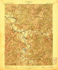
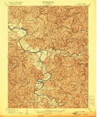
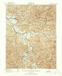
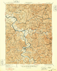
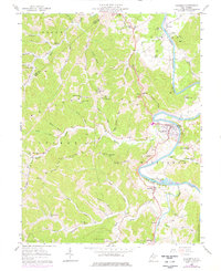
Loading map...1906 Map of Elizabeth
USGS Topo · Published 1906About this map
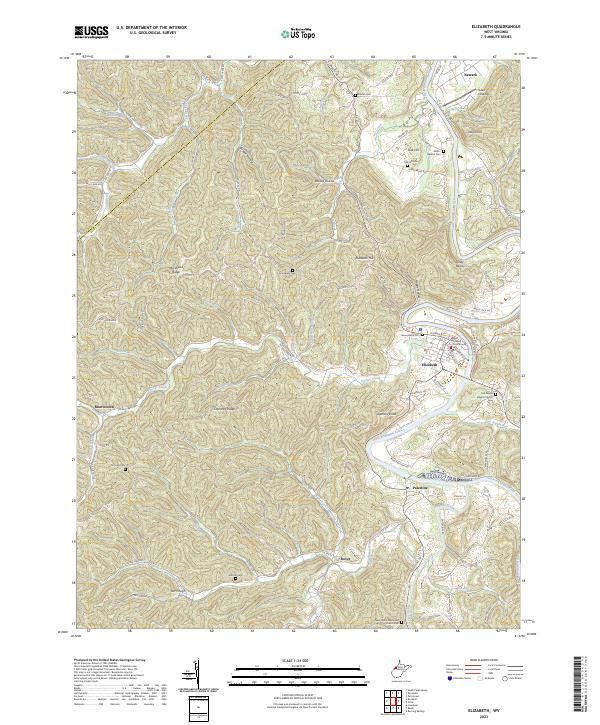
The Little Kanawha River serves as the primary artery through this West Virginia landscape, winding past the county seat of Elizabeth and the settlement of Palestine. In this era before modern highways, the movement of goods and people relied on the Baltimore and Ohio RR in the north and a network of historic thoroughfares including the Northwestern Turnpike and the Staunton and Parkersburg Turnpike.
Find a feature on this map
115 named features on this map. Tap any name to fly to it.
Don’t see what you’re looking for? This feature index may not catch every label — zoom into the map to look around manually.
Map Details
Date Portrayed1906
Date Published1906
PublisherU.S. Geological Survey
Map TypeTopographic
Scale1:62,500
Physical Dimensions16.5 x 19.91 inches
Editions of this 1906 Elizabeth Map
2 editions found
Historical Maps of Elizabeth Through Time
5 maps found
Featured Locations
Source Details
SourceU.S. Geological Survey
CopyrightPublic Domain