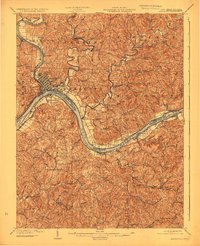
1904 Map of Marietta
USGS Topo · Published 1923About this map
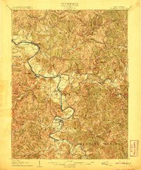
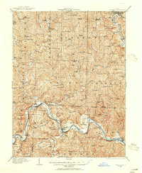
The confluence of the Muskingum River and the Ohio River serves as the focal point for this turn-of-the-century riverfront survey. In Marietta, a dense street grid meets the water, connected by the Baltimore and Ohio R. R. and the designated Steamboat Route. Across the water, Williamstown and Harman flank the major river bends, while upstream navigation is supported by structures like Lock No 2.
Find a feature on this map
62 named features on this map. Tap any name to fly to it.
Don’t see what you’re looking for? This feature index may not catch every label — zoom into the map to look around manually.
Map Details
Editions of this 1904 Marietta Map
This is the sole edition of this map. No revisions or reprints were ever made.
Other maps of this area

1902 · Parkersburg
USGS Topo · 1:62,500

1903 · Macksburg
USGS Topo · 1:62,500

1904 · Parkersburg
USGS Topo · 1:62,500

1905 · New Matamoras
USGS Topo · 1:62,500

1905 · Macksburg
USGS Topo · 1:62,500

1906 · Saint Marys
USGS Topo · 1:62,500
1906 · Elizabeth
USGS Topo · 1:62,500

1906 · Belleville
USGS Topo · 1:62,500

1907 · Harrisville
USGS Topo · 1:62,500
1909 · Caldwell
USGS Topo · 1:62,500