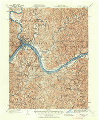
1924 Map of Marietta
USGS Topo · Published 1962About this map
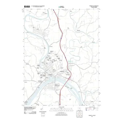
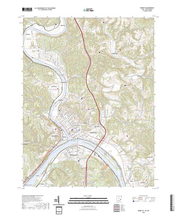
The Muskingum River meets the Ohio River at Marietta, where this 1924 revision of 1902 topography documents a landscape defined by its riverine geography and early transport networks. The Baltimore and Ohio RR follows the northern bank of the Ohio, connecting the regional hub of Marietta with outlying river settlements like Reno and Sandhill. Across the water, Williamstown sits near the head of Buckley Island, while the interior of West Virginia is dotted with small-scale rural landmarks that reveal the era's social fabric. Numerous hilltop schools and churches, such as the Oak Grove School, Social Chapel, and Bethel Church, are scattered through the winding valleys of Horseneck Creek and Bull Creek. The map also captures the Steamboat Route on the Muskingum, reflecting a period when water transit remained vital for commerce between towns like Rainbow and Stanleyville.
Find a feature on this map
103 named features on this map. Tap any name to fly to it.
Don’t see what you’re looking for? This feature index may not catch every label — zoom into the map to look around manually.
Map Details
Editions of this 1924 Marietta Map
This is the sole edition of this map. No revisions or reprints were ever made.
Historical Maps of Marietta Through Time
11 maps found
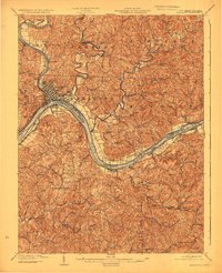
1904 Marietta
Washington County, OH
1924 Marietta
Washington County, OH
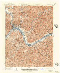
1927 Marietta
Washington County, OH
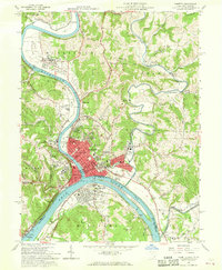
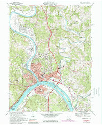
1957 Marietta
Washington County, OH
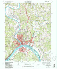
1969 Marietta
Washington County, OH
1994 Marietta
Washington County, OH
2011 Marietta
Washington County, OH
2013 Marietta
Washington County, OH
2016 Marietta
Washington County, OH
2019 Marietta
Washington County, OH
2023 Marietta
Washington County, OH