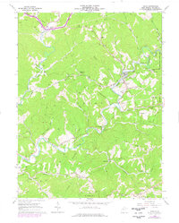
1964 Map of Cairo
USGS Topo · Published 1976About this map
The North Fork Hughes River and the Baltimore and Ohio railroad corridor define the industrial and social landscape of this West Virginia territory. Centered on the town of Cairo, the map reveals a region defined by mid-century energy extraction, with extensive Oil Field and gas networks stretching across the Grant and Murphy districts. The infrastructure of the era is evident in the numerous Compressor Stations and the intricate web of Pipelines that traverse the wooded hills.
Find a feature on this map
67 named features on this map. Tap any name to fly to it.
Don’t see what you’re looking for? This feature index may not catch every label — zoom into the map to look around manually.
Map Details
Editions of this 1964 Cairo Map
3 editions found
Other maps of this area

1904 · Marietta
USGS Topo · 1:62,500

1906 · Saint Marys
USGS Topo · 1:62,500

1906 · Elizabeth
USGS Topo · 1:62,500

1907 · Harrisville
USGS Topo · 1:62,500

1924 · St Marys
USGS Topo · 1:62,500

1924 · Harrisville
USGS Topo · 1:62,500

1924 · Marietta
USGS Topo · 1:62,500

1924 · Elizabeth
USGS Topo · 1:62,500

1926 · Elizabeth
USGS Topo · 1:62,500

1926 · Harrisville
USGS Topo · 1:62,500