
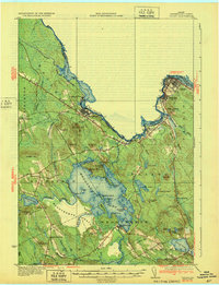
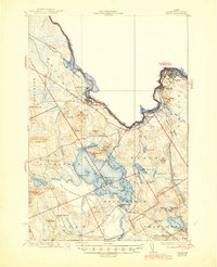
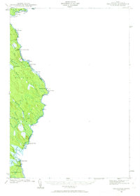
1932 Map of Calais
USGS Topo · Published 1932About this map
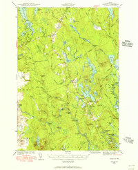
The St Croix River defines the international boundary between Maine and New Brunswick, serving as the industrial and transit corridor for the border communities of Calais and Milltown. This 1930s-era landscape reveals a region transitioning from raw timber extraction to organized industrial sites, notably at Woodland, where the Maine Central railroad meets the river at Woodland June. The interior is dominated by a complex network of glacial lakes and streams, with Meddybemps Lake at its heart, dotted with named landmarks like Masters Island and Stone Camp.
Find a feature on this map
84 named features on this map. Tap any name to fly to it.
Don’t see what you’re looking for? This feature index may not catch every label — zoom into the map to look around manually.
Map Details
Editions of this 1932 Calais Map
4 editions found
Other maps of this area

1907 · Eastport
USGS Topo · 1:48,000

1908 · Eastport
USGS Topo · 1:62,500

1929 · Calais
USGS Topo · 1:48,000
1929 · Robbinston
USGS Topo · 1:48,000
1931 · Robbinston
USGS Topo · 1:62,500

1932 · Calais
USGS Topo · 1:62,500

1940 · Waite
USGS Topo · 1:62,500
1940 · Kellyland
USGS Topo · 1:62,500
1941 · Wesley
USGS Topo · 1:62,500

1941 · Gardner Lake
USGS Topo · 1:62,500