2022 Map of Calumet
USGS Topo · Published 2022About this map
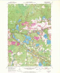
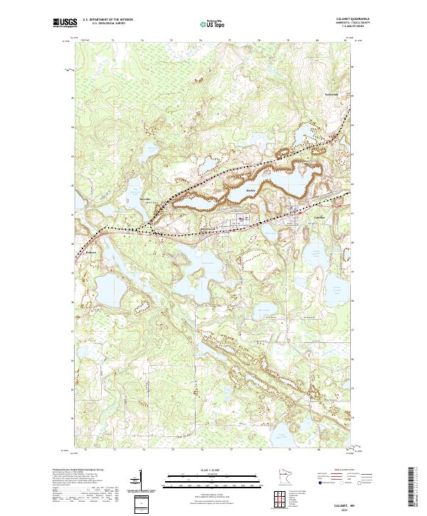
The Mesabi Range defines the industrial and residential character of this northern Minnesota landscape, where the iron ore legacy is visible in the complex contours of Calumet, Marble, and Nashwauk. The terrain is a mixture of steep industrial alterations and natural hydrology, featuring local landmarks like Hill Annex Pond One and Upper Panaca Lake. Smaller residential pockets such as Taconite, Silverwood, and Holman are connected by a network of local roads like Fayette Rd and Silverwood Ave, while Highway 169 serves as the primary regional artery. Beyond the iron mining activity, the southern portion of the map transitions into a dense lake and river system. The Swan River meanders through the landscape, feeding into and passing by numerous bodies of water including Loon Lake, Bass Lake, and Foot Lake. This area provides a clear view of how the residential grid of the Iron Range towns interfaces with the extensive wetlands and brooks of the t56n r23w and t55n r23w townships.
Find a feature on this map
62 named features on this map. Tap any name to fly to it.
Don’t see what you’re looking for? This feature index may not catch every label — zoom into the map to look around manually.
Map Details
Editions of this 2022 Calumet Map
This is the sole edition of this map. No revisions or reprints were ever made.