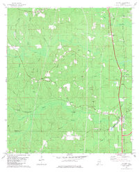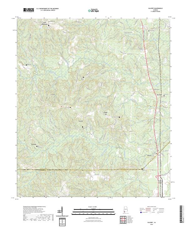
2024 Map of Calvert
USGS Topo · Published 2024About this map
The border of Washington and Mobile Counties defines the southern reaches of this landscape, where the BNSF Railway parallels the river lowlands. This corridor connects several small communities including Calvert, Malcolm, and Mount Vernon, serving as a vital transport artery through the undulating terrain of Sandy Ridge Road and Hurricane Ridge. To the west, the landscape is punctuated by family and community landmarks like Reid Settlement and Fairford, alongside numerous small burial grounds such as Hillspring Cem and Liberty Cem.
Find a feature on this map
83 named features on this map. Tap any name to fly to it.
Don’t see what you’re looking for? This feature index may not catch every label — zoom into the map to look around manually.
Map Details
Editions of this 2024 Calvert Map
This is the sole edition of this map. No revisions or reprints were ever made.