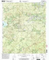
2003 Map of Calvin
USGS Topo · Published 2005About this map
Kisatchie National Forest dominates this section of Louisiana, characterized by a complex network of drainages and small settlements. The community of Calvin sits at the junction of several local routes, featuring a nearby Athletic Field and McDade Memorial Park. To the northwest, the map documents the settlement of Coldwater and the expansive waters of Saline Lake. Local history is preserved through numerous family-named cemeteries and rural houses of worship, including the Old Harmony Cem, Sanders Chapel Cem, and Saline Grove Ch. The landscape is etched with secondary roads like Telephone Road and Gum Springs Road, which lead to specialized sites such as the Gum Springs Work Center and scattered resources like a Gas Well near Kutates Branch.
Find a feature on this map
44 named features on this map. Tap any name to fly to it.
Don’t see what you’re looking for? This feature index may not catch every label — zoom into the map to look around manually.
Map Details
Editions of this 2003 Calvin Map
This is the sole edition of this map. No revisions or reprints were ever made.
Other maps of this area

1947 · Goldonna
USGS Topo · 1:62,500

1949 · Calvin SE
USGS Topo · 1:31,680

1949 · Calvin NE
USGS Topo · 1:31,680

1949 · Calvin NW
USGS Topo · 1:31,680

1949 · Calvin SW
USGS Topo · 1:31,680

1949 · Jonesboro
USGS Topo · 1:62,500

1950 · Jonesboro
USGS Topo · 1:62,500

1950 · Winnfield
USGS Topo · 1:62,500

1951 · Winnfield
USGS Topo · 1:62,500

1953 · Alexandria
USGS Topo · 1:250,000