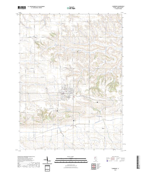
2024 Map of Cambridge
USGS Topo · Published 2024About this map
The Henry County Courthouse stands as the central landmark of Cambridge, anchoring a landscape where the grid of Illinois cornfields meets the meandering waters of the Edwards River. This modern topographic study reveals a well-established agricultural and civic hub, with the township structure clearly defined by a network of numbered roads like N 1500th Ave and E 1000th St. To the south, the village of Ulah sits near the riverbanks, while the surrounding countryside is dotted with sites of genealogical importance, including Grace Episcopal Cem and Mc Nay Cem. Drainage patterns are finely detailed, showing the convergence of Mineral Creek, Spring Creek, and Hillery Creek as they carve through the Henry County prairie. The map provides a precise account of local infrastructure, from the residential streets of the county seat to the secluded Valley View Club Lake tucked away along Timber Ridge Rd.
Find a feature on this map
62 named features on this map. Tap any name to fly to it.
Don’t see what you’re looking for? This feature index may not catch every label — zoom into the map to look around manually.
Map Details
Editions of this 2024 Cambridge Map
This is the sole edition of this map. No revisions or reprints were ever made.
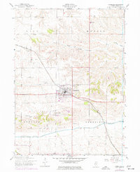
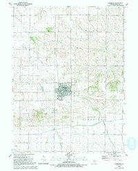
Historical Maps of Cambridge Through Time
3 maps found