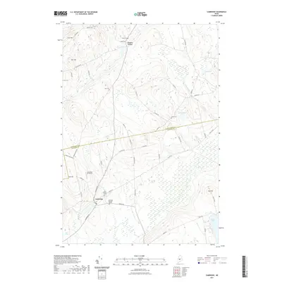
2021 Map of Cambridge
USGS Topo · Published 2021About this map
The town of Cambridge sits at the junction of Guilford Rd and Dexter Rd, serving as a central hub for this portion of the Piscataquis and Somerset County border. This modern landscape is defined by its numerous family-named landmarks and small burial grounds, including Tyler Cem, Gilbert Cem, and the Mount Pleasant Cem near the town center. The terrain is characterized by low peaks such as Crow Hill and Ham Hill, which overlook a network of wetlands and small water bodies like Pingree Pond and Mud Pond.
Find a feature on this map
51 named features on this map. Tap any name to fly to it.
Don’t see what you’re looking for? This feature index may not catch every label — zoom into the map to look around manually.
Map Details
Editions of this 2021 Cambridge Map
This is the sole edition of this map. No revisions or reprints were ever made.
Other maps of this area

1913 · Skowhegan
USGS Topo · 1:62,500

1930 · Pittsfield
USGS Topo · 1:48,000

1932 · Pittsfield
USGS Topo · 1:62,500

1933 · Pittsfield
USGS Topo · 1:62,500

1933 · Guilford
USGS Topo · 1:62,500

1937 · Guilford
USGS Topo · 1:62,500

1948 · Bangor
USGS Topo · 1:250,000

1948 · Kingsbury
USGS Topo · 1:62,500

1950 · Kingsbury
USGS Topo · 1:62,500

1954 · Millinocket
USGS Topo · 1:250,000