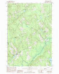
1984 Map of Cambridge
USGS Topo · Published 1984About this map
The Sebasticook River and Main Stream converge in this northern Maine landscape, defining the rural character of the borderlands between Piscataquis and Somerset counties. The village of Cambridge sits near the shore of Cambridge Pond, serving as a central hub for the surrounding network of hills and small waterways. Further north, the settlement at Pingree Center occupies a clearing near Pingree Center Stream, illustrating the scattered residential patterns common in this timber-rich region during the early 1980s.
Find a feature on this map
41 named features on this map. Tap any name to fly to it.
Don’t see what you’re looking for? This feature index may not catch every label — zoom into the map to look around manually.
Map Details
Editions of this 1984 Cambridge Map
This is the sole edition of this map. No revisions or reprints were ever made.
Other maps of this area

1913 · Skowhegan
USGS Topo · 1:62,500

1930 · Pittsfield
USGS Topo · 1:48,000

1932 · Pittsfield
USGS Topo · 1:62,500

1933 · Pittsfield
USGS Topo · 1:62,500

1933 · Guilford
USGS Topo · 1:62,500

1937 · Guilford
USGS Topo · 1:62,500

1948 · Bangor
USGS Topo · 1:250,000

1948 · Kingsbury
USGS Topo · 1:62,500

1950 · Kingsbury
USGS Topo · 1:62,500

1954 · Millinocket
USGS Topo · 1:250,000