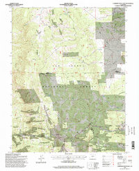
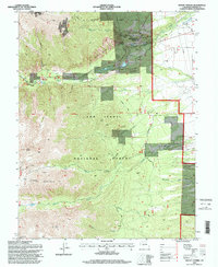
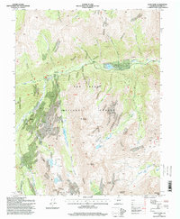
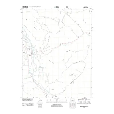
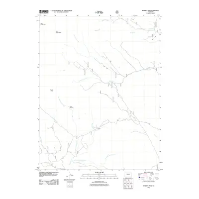
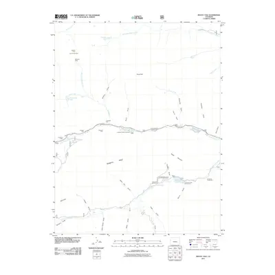
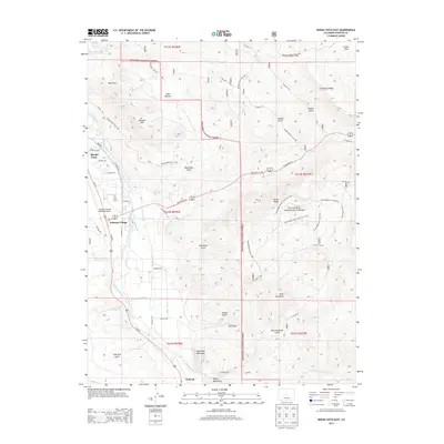
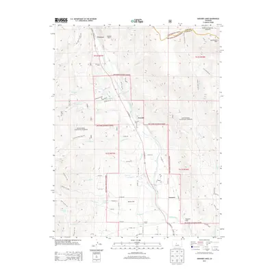
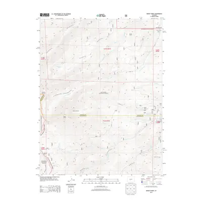
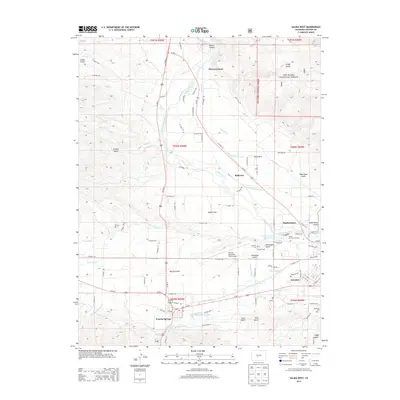
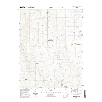
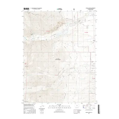
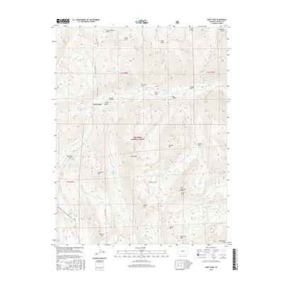
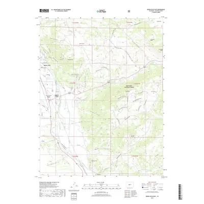
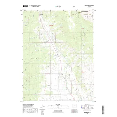
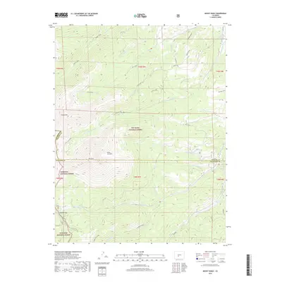
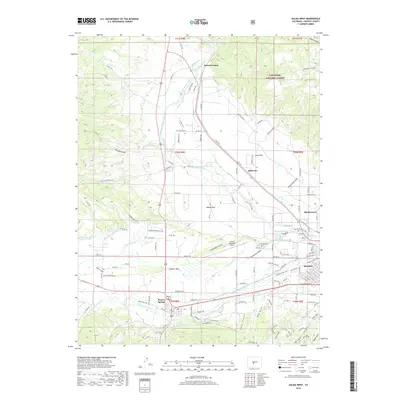
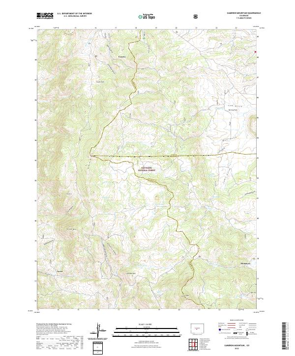
1983 Map of Cameron Mountain
USGS Topo · Published 1983About this map
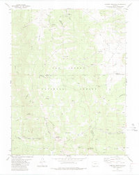
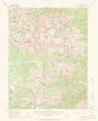
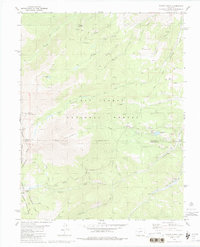
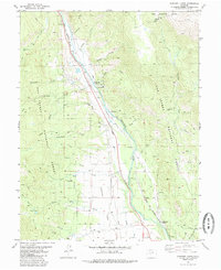
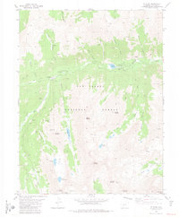
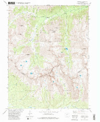
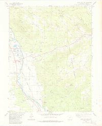
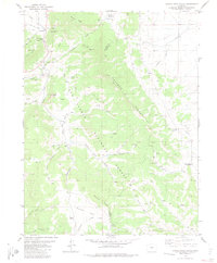
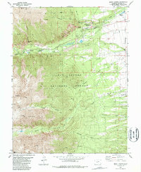
Calumet Mountain and the high ridges of the San Isabel National Forest dominate this mountain landscape, which sits at the juncture of Chaffee, Park, and Fremont counties. This mid-1980s USGS study reveals an area defined by mineral extraction and alpine water sources, with a network of mining claims such as the Marble Quarry and numerous unnamed Mines dotting the terrain. The presence of the Bassam Guard Station and multiple Jeep trails indicates a landscape managed for both timber and recreation.
Find a feature on this map
45 named features on this map. Tap any name to fly to it.
Don’t see what you’re looking for? This feature index may not catch every label — zoom into the map to look around manually.
Map Details
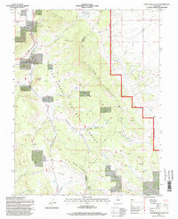
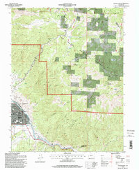
Editions of this 1983 Cameron Mountain Map
This is the sole edition of this map. No revisions or reprints were ever made.
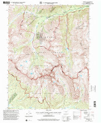
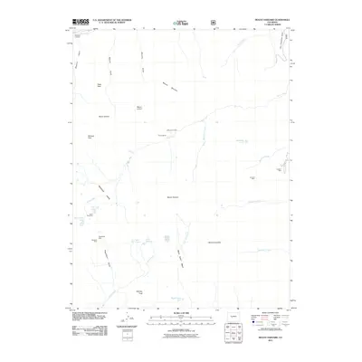
Historical Maps of Whitehorn Through Time
99 maps found
1955 Mount Harvard
Chaffee County, CO
1980 Mount Ouray
Chaffee County, CO
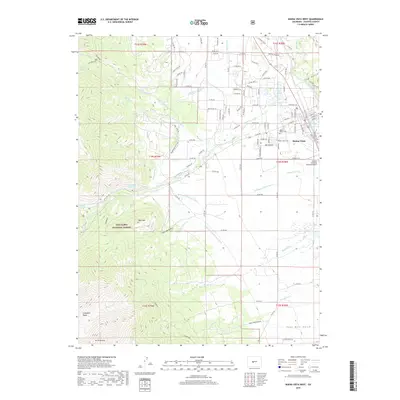
1982 Buena Vista West
Chaffee County, CO
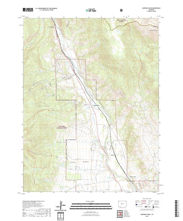
1982 Harvard Lakes
Chaffee County, CO
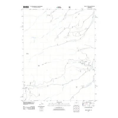
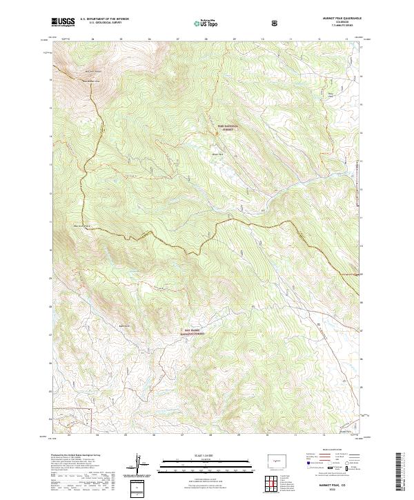
1982 Marmot Peak
Chaffee County, CO
1982 Mount Harvard
Chaffee County, CO
1982 Mount Yale
Chaffee County, CO
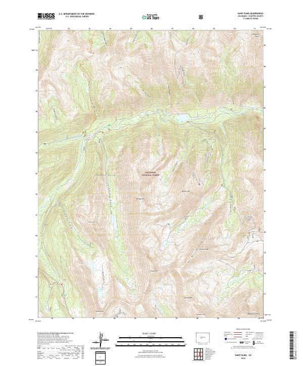
1982 Saint Elmo
Chaffee County, CO
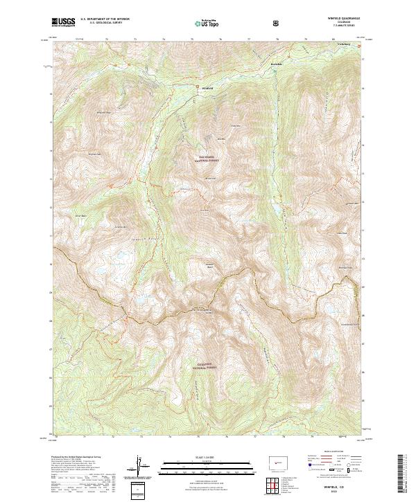
1982 Winfield
Chaffee County, CO
1983 Buena Vista East
Chaffee County, CO
1983 Cameron Mountain
Chaffee County, CO
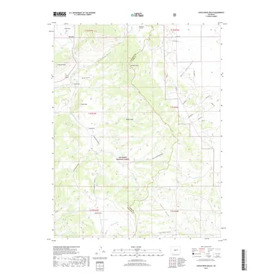
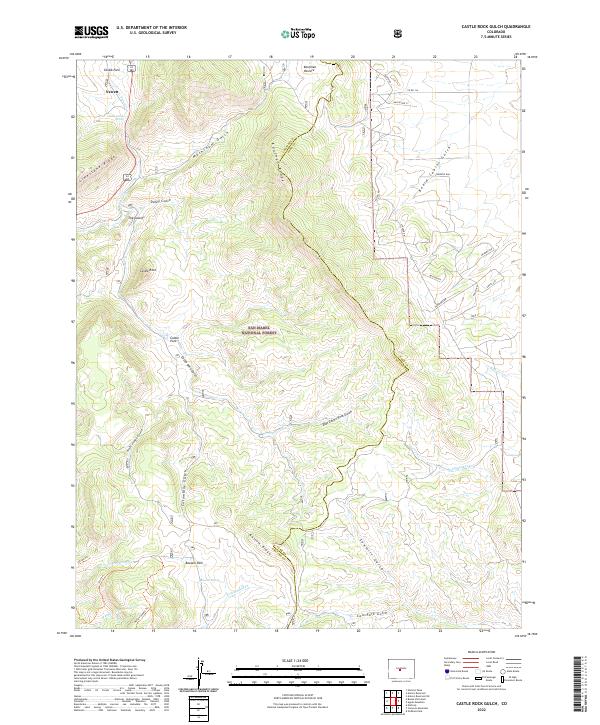
1983 Castle Rock Gulch
Chaffee County, CO
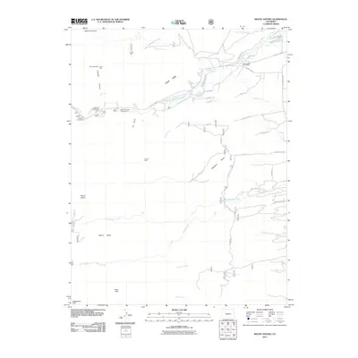
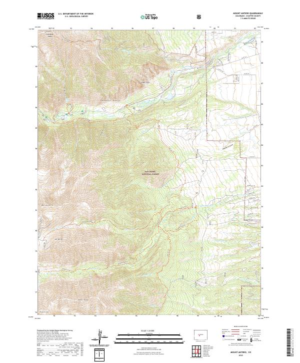
1983 Mount Antero
Chaffee County, CO
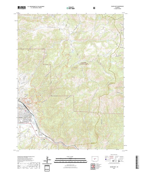
1983 Salida East
Chaffee County, CO
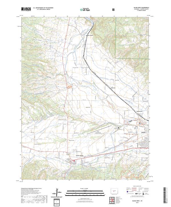
1983 Salida West
Chaffee County, CO

1994 Buena Vista East
Chaffee County, CO
1994 Buena Vista West
Chaffee County, CO
1994 Cameron Mountain
Chaffee County, CO
1994 Castle Rock Gulch
Chaffee County, CO
1994 Harvard Lakes
Chaffee County, CO
1994 Marmot Peak
Chaffee County, CO
1994 Mount Antero
Chaffee County, CO
1994 Mount Harvard
Chaffee County, CO
1994 Mount Ouray
Chaffee County, CO
1994 Mount Yale
Chaffee County, CO
1994 Saint Elmo
Chaffee County, CO
1994 Salida East
Chaffee County, CO
1994 Salida West
Chaffee County, CO
1994 Winfield
Chaffee County, CO
2011 Buena Vista East
Chaffee County, CO
2011 Buena Vista West
Chaffee County, CO
2011 Cameron Mountain
Chaffee County, CO

2011 Castle Rock Gulch
Chaffee County, CO
2011 Harvard Lakes
Chaffee County, CO
2011 Marmot Peak
Chaffee County, CO
2011 Mount Antero
Chaffee County, CO
2011 Mount Harvard
Chaffee County, CO
2011 Mount Ouray
Chaffee County, CO
2011 Mount Yale
Chaffee County, CO
2011 Saint Elmo
Chaffee County, CO
2011 Salida East
Chaffee County, CO
2011 Salida West
Chaffee County, CO

2011 Winfield
Chaffee County, CO
2013 Buena Vista East
Chaffee County, CO
2013 Buena Vista West
Chaffee County, CO
2013 Cameron Mountain
Chaffee County, CO
2013 Castle Rock Gulch
Chaffee County, CO
2013 Harvard Lakes
Chaffee County, CO
2013 Marmot Peak
Chaffee County, CO
2013 Mount Antero
Chaffee County, CO
2013 Mount Harvard
Chaffee County, CO
2013 Mount Ouray
Chaffee County, CO
2013 Mount Yale
Chaffee County, CO
2013 Saint Elmo
Chaffee County, CO
2013 Salida East
Chaffee County, CO
2013 Salida West
Chaffee County, CO
2013 Winfield
Chaffee County, CO
2016 Buena Vista East
Chaffee County, CO
2016 Buena Vista West
Chaffee County, CO
2016 Cameron Mountain
Chaffee County, CO
2016 Castle Rock Gulch
Chaffee County, CO
2016 Harvard Lakes
Chaffee County, CO
2016 Marmot Peak
Chaffee County, CO
2016 Mount Antero
Chaffee County, CO
2016 Mount Harvard
Chaffee County, CO
2016 Mount Ouray
Chaffee County, CO
2016 Mount Yale
Chaffee County, CO
2016 Saint Elmo
Chaffee County, CO
2016 Salida East
Chaffee County, CO
2016 Salida West
Chaffee County, CO
2016 Winfield
Chaffee County, CO
2019 Buena Vista East
Chaffee County, CO
2019 Buena Vista West
Chaffee County, CO
2019 Cameron Mountain
Chaffee County, CO
2019 Castle Rock Gulch
Chaffee County, CO
2019 Harvard Lakes
Chaffee County, CO
2019 Marmot Peak
Chaffee County, CO
2019 Mount Antero
Chaffee County, CO
2019 Mount Harvard
Chaffee County, CO
2019 Mount Ouray
Chaffee County, CO
2019 Mount Yale
Chaffee County, CO
2019 Saint Elmo
Chaffee County, CO
2019 Salida East
Chaffee County, CO
2019 Salida West
Chaffee County, CO
2019 Winfield
Chaffee County, CO
2022 Buena Vista East
Chaffee County, CO
2022 Buena Vista West
Chaffee County, CO
2022 Cameron Mountain
Chaffee County, CO
2022 Castle Rock Gulch
Chaffee County, CO
2022 Harvard Lakes
Chaffee County, CO
2022 Marmot Peak
Chaffee County, CO
2022 Mount Antero
Chaffee County, CO
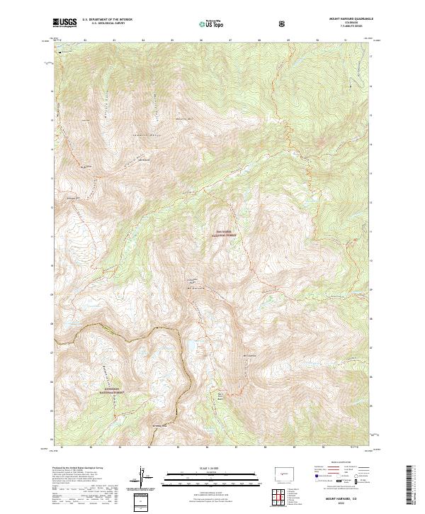
2022 Mount Harvard
Chaffee County, CO
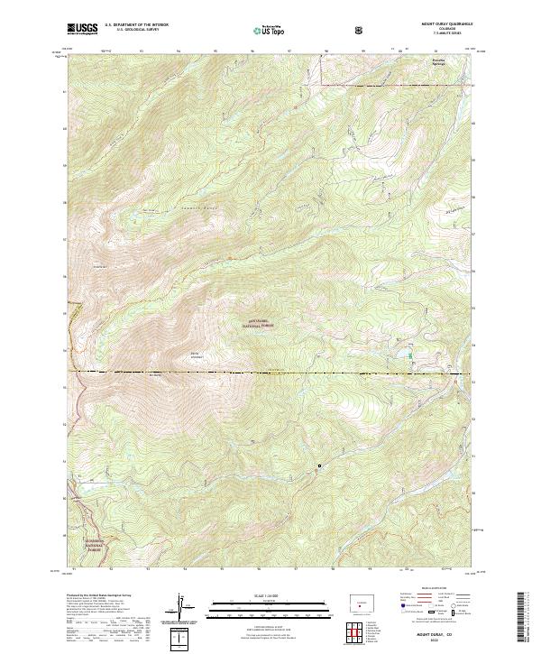
2022 Mount Ouray
Chaffee County, CO
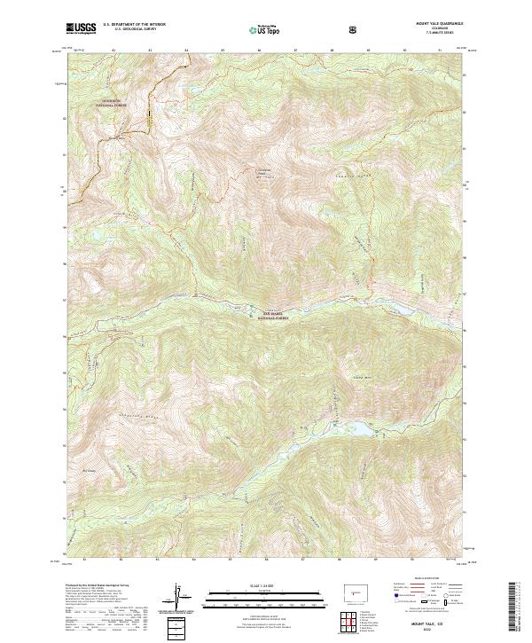
2022 Mount Yale
Chaffee County, CO
2022 Saint Elmo
Chaffee County, CO
2022 Salida East
Chaffee County, CO
2022 Winfield
Chaffee County, CO
2023 Salida West
Chaffee County, CO