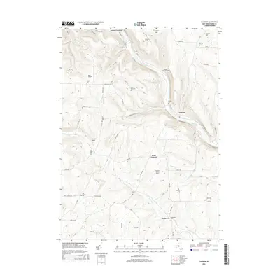
2016 Map of Cameron
USGS Topo · Published 2016About this map
The Canisteo River carves a deep valley through this Steuben County landscape, serving as the primary corridor for settlements like West Cameron and Cameron. This 2016 survey illustrates a rural region defined by its narrow valley floors and high, named ridges such as Kinners Knob and Cobble Knob. The transport network follows the water, with Co Rte 119 and Canisteo River Rd hugging the riverbanks, while secondary routes like Cameron-North Jasper Rd climb into the surrounding hills.
Find a feature on this map
76 named features on this map. Tap any name to fly to it.
Don’t see what you’re looking for? This feature index may not catch every label — zoom into the map to look around manually.
Map Details
Editions of this 2016 Cameron Map
This is the sole edition of this map. No revisions or reprints were ever made.
Other maps of this area

1910 · Bath
USGS Topo · 1:62,500

1915 · Hornell
USGS Topo · 1:62,500

1918 · Hornell
USGS Topo · 1:62,500

1924 · Woodhull
USGS Topo · 1:48,000

1926 · Woodhull
USGS Topo · 1:62,500

1926 · Greenwood
USGS Topo · 1:62,500

1944 · Woodhull
USGS Topo · 1:62,500

1950 · Elmira
USGS Topo · 1:250,000

1953 · Cameron
USGS Topo · 1:24,000

1953 · Woodhull
USGS Topo · 1:24,000