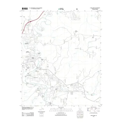
1923 Map of Camp Verde
USGS Topo · Published 1923About this map
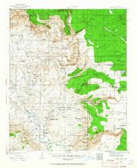
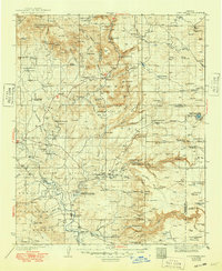
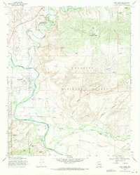
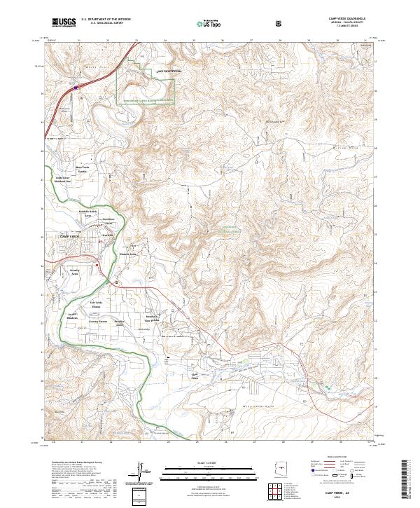
The Verde River valley serves as the central artery of this 1923 survey, compiled by N.H.Darton from Forest Service sheets and earlier topographical work. This era of the Arizona interior is defined by its transition from frontier military outposts to more permanent agricultural and recreational settlements. Landmarks such as Montezuma Castle Nat Monument and Montezuma Well highlight the early recognition of the region's archeological significance, while towns like Clemenceau and Camp Verde anchor the local economy. The landscape is dominated by the massive rise of the Mogollon Rim and the Coconino National Forest, where high-country features like Mormon Lake and Stoneman Lake contrast with the riparian corridors of Oak Creek and Wet Beaver Creek. This map captures the intricate drainage patterns that supported early ranching and mining operations in Yavapai and Coconino counties.
Find a feature on this map
33 named features on this map. Tap any name to fly to it.
Don’t see what you’re looking for? This feature index may not catch every label — zoom into the map to look around manually.
Map Details
Editions of this 1923 Camp Verde Map
This is the sole edition of this map. No revisions or reprints were ever made.
Historical Maps of Cottonwood Through Time
9 maps found