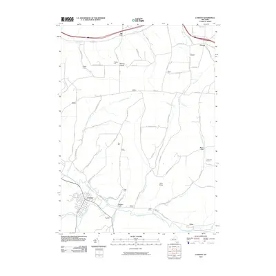
2010 Map of Canisteo
USGS Topo · Published 2010About this map
Canisteo and the winding Canisteo River anchor this topographic study of Steuben County, where the valley floor transitions into high ridges and named hollows. The settlement pattern reflects a deeply rooted rural community, with small clusters like Canisteo Center, Buena Vista, and Butcher Corner connected by a network of upland roads such as Turnpike Rd and Graves Hill Rd.
Find a feature on this map
75 named features on this map. Tap any name to fly to it.
Don’t see what you’re looking for? This feature index may not catch every label — zoom into the map to look around manually.
Map Details
Editions of this 2010 Canisteo Map
This is the sole edition of this map. No revisions or reprints were ever made.
Other maps of this area

1910 · Bath
USGS Topo · 1:62,500

1915 · Hornell
USGS Topo · 1:62,500

1918 · Hornell
USGS Topo · 1:62,500

1924 · Woodhull
USGS Topo · 1:48,000

1926 · Woodhull
USGS Topo · 1:62,500

1926 · Greenwood
USGS Topo · 1:62,500

1944 · Woodhull
USGS Topo · 1:62,500

1950 · Elmira
USGS Topo · 1:250,000

1953 · Cameron
USGS Topo · 1:24,000
1953 · Avoca
USGS Topo · 1:24,000