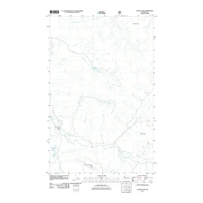
2011 Map of Canyon Lake
USGS Topo · Published 2011About this map
Canyon Lake and the winding course of the Middle Fork Nooksack River dominate this pocket of the North Cascades foothills. The landscape is defined by its drainage network, where Canyon Creek, Porter Creek, and Clearwater Creek carve through the high elevations between Stewart Peak and Slide Mountain. This 2011 survey records a remote area primarily utilized for forest access and lookout duties, evidenced by the Nooksack Lookout atop Bowman Mountain. Small water bodies like Mosquito Lake and Jorgensen Lake sit near the valley floor, connected by Mosquito Lake Rd and the Mosquito Lake Road Bridge. The presence of numerous named tributaries, including Racehorse Creek and Toboggan Creek, provides a clear view of the watershed's complex topography before the terrain climbs toward the higher Cascades peaks to the east.
Find a feature on this map
23 named features on this map. Tap any name to fly to it.
Don’t see what you’re looking for? This feature index may not catch every label — zoom into the map to look around manually.
Map Details
Editions of this 2011 Canyon Lake Map
This is the sole edition of this map. No revisions or reprints were ever made.
Other maps of this area

1909 · Mt Baker
USGS Topo · 1:192,000

1915 · Mt. Baker
USGS Topo · 1:250,000

1919 · Van Zandt
USGS Topo · 1:62,500

1921 · Wickersham
USGS Topo · 1:62,500

1951 · Wickersham
USGS Topo · 1:62,500

1951 · Van Zandt
USGS Topo · 1:62,500

1952 · Mt. Baker
USGS Topo · 1:62,500

1952 · Hamilton
USGS Topo · 1:62,500

1955 · Concrete
USGS Topo · 1:250,000

1957 · Victoria
USGS Topo · 1:250,000