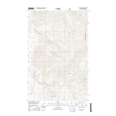
2014 Map of Canyon Lake
USGS Topo · Published 2014About this map
Canyon Lake and the surrounding high-elevation terrain of Mount Baker National Forest define this 2014 survey of Whatcom County. The landscape is characterized by a complex drainage network where Canyon Creek and Toboggan Creek feed into the central lake, while the Middle Fork Nooksack River cuts through the southern portion of the quadrangle. Local infrastructure is concentrated in the southwest corner along Mosquito Lake Road, featuring the Mosquito Lake Road Bridge and access to Mosquito Lake and Jorgensen Lake. Significant peaks such as Slide Mountain, Stewart Peak, and Bowman Mountain anchor the topography, with the Nooksack Lookout standing as a key point of interest for those tracking historical forest service landmarks and the management of these timbered heights.
Find a feature on this map
28 named features on this map. Tap any name to fly to it.
Don’t see what you’re looking for? This feature index may not catch every label — zoom into the map to look around manually.
Map Details
Editions of this 2014 Canyon Lake Map
This is the sole edition of this map. No revisions or reprints were ever made.
Other maps of this area

1909 · Mt Baker
USGS Topo · 1:192,000

1915 · Mt. Baker
USGS Topo · 1:250,000

1919 · Van Zandt
USGS Topo · 1:62,500

1921 · Wickersham
USGS Topo · 1:62,500

1951 · Wickersham
USGS Topo · 1:62,500

1951 · Van Zandt
USGS Topo · 1:62,500

1952 · Mt. Baker
USGS Topo · 1:62,500

1952 · Hamilton
USGS Topo · 1:62,500

1955 · Concrete
USGS Topo · 1:250,000

1957 · Victoria
USGS Topo · 1:250,000