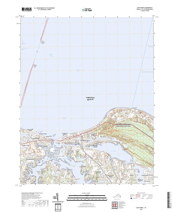
2022 Map of Cape Henry
USGS Topo · Published 2022About this map
Cape Henry stands as a pivotal coastal landmark where the Chesapeake Bay meets the Atlantic Ocean. This map illustrates the highly complex shoreline of Virginia Beach, characterized by an intricate network of waterways including Lynnhaven Bay, Broad Bay, and Linkhorn Bay. The massive engineering of the Chesapeake Bay Bridge-Tunnel is clearly visible, spanning the water via the North Thimble Island and South Thimble Island transitions. Inland, the map reveals a dense pattern of established residential communities such as Thoroughgood, Alanton, and Cape Story by the Sea. These neighborhoods are often defined by their relationship to the water, with developments like Great Neck Estates and Bay Island positioned along the numerous coves and drains that penetrate the peninsula, while Bayville Park offers significant recreational space amidst the suburban growth.
Find a feature on this map
168 named features on this map. Tap any name to fly to it.
Don’t see what you’re looking for? This feature index may not catch every label — zoom into the map to look around manually.
Map Details
Editions of this 2022 Cape Henry Map
This is the sole edition of this map. No revisions or reprints were ever made.
Other maps of this area

1893 · Virginia Beach
USGS Topo · 1:125,000

1907 · Norfolk
USGS Topo · 1:125,000

1918 · Cape Henry
USGS Topo · 1:62,500

1919 · Cape Henry
USGS Topo · 1:62,500

1943 · Richmond
USGS Topo · 1:250,000

1946 · Eastville
USGS Topo · 1:250,000

1946 · Currituck Sound
USGS Topo · 1:250,000

1948 · Ocean View
USGS Topo · 1:24,000
1948 · Virginia Beach
USGS Topo · 1:24,000
1948 · Princess Anne
USGS Topo · 1:24,000