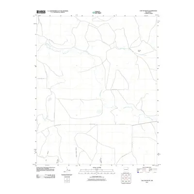
2010 Map of Car Top Butte
USGS Topo · Published 2010About this map
Car Top Butte anchors this high-plains landscape in Union County, where a network of ephemeral drainages and canyons carve through the northeastern New Mexico terrain. The drainage patterns of Pinabetes Creek and Moscow Creek dominate the central and eastern portions of the quadrangle, illustrating the complex hydrology of this ranching region. The map reveals a specialized naming convention for the local topography, featuring several distinct canyons including Charley Adams Canyon, San Lorenzo Canyon, and Ute Canyon in the southern reaches. This 2010 survey provides a modern snapshot of the area's rural transportation infrastructure, defined by a grid of county roads such as County Hwy C-025 and Barney Rd that serve the outlying ranch lands and navigate around the winding paths of Leon Creek and Zorcillo Creek.
Find a feature on this map
18 named features on this map. Tap any name to fly to it.
Don’t see what you’re looking for? This feature index may not catch every label — zoom into the map to look around manually.
Map Details
Editions of this 2010 Car Top Butte Map
This is the sole edition of this map. No revisions or reprints were ever made.
Other maps of this area

1954 · Dalhart
USGS Topo · 1:250,000

1958 · Dalhart
USGS Topo · 1:250,000

1962 · Dalhart
USGS Topo · 1:250,000

1966 · Skull Mesa
USGS Topo · 1:24,000

1966 · Pedernal Creek
USGS Topo · 1:24,000

1966 · Tate School
USGS Topo · 1:24,000

1966 · Clapham
USGS Topo · 1:24,000

1966 · Car Top Butte
USGS Topo · 1:24,000

1966 · Sand Hill
USGS Topo · 1:24,000

1973 · Garcia Creek
USGS Topo · 1:24,000