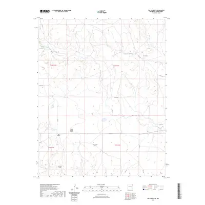
2023 Map of Car Top Butte
USGS Topo · Published 2023About this map
Car Top Butte stands as a prominent landmark in this high plains landscape of Union County, New Mexico. The terrain is deeply incised by a series of drainage systems, most notably Pinabetes Creek and Moscow Creek, which flow through the northern reaches of the quadrangle. These waterways have carved significant depressions across the mesas, creating complex topographies such as Charley Adams Canyon and Ute Canyon. In the southern half of the sheet, the landform transitions into a network of steep-walled gaps including San Lorenzo Canyon and Los Gatos Canyon. This area reflects a traditional ranching environment where movement is dictated by the natural breaks in the land. A grid of local thoroughfares like Blue Front Rd and Robinett Rd provides access across the open range, following the section lines and natural contours between the creek beds and canyons.
Find a feature on this map
24 named features on this map. Tap any name to fly to it.
Don’t see what you’re looking for? This feature index may not catch every label — zoom into the map to look around manually.
Map Details
Editions of this 2023 Car Top Butte Map
This is the sole edition of this map. No revisions or reprints were ever made.
Other maps of this area

1954 · Dalhart
USGS Topo · 1:250,000

1958 · Dalhart
USGS Topo · 1:250,000

1962 · Dalhart
USGS Topo · 1:250,000

1966 · Skull Mesa
USGS Topo · 1:24,000

1966 · Pedernal Creek
USGS Topo · 1:24,000

1966 · Tate School
USGS Topo · 1:24,000

1966 · Clapham
USGS Topo · 1:24,000

1966 · Car Top Butte
USGS Topo · 1:24,000

1966 · Sand Hill
USGS Topo · 1:24,000

1973 · Garcia Creek
USGS Topo · 1:24,000