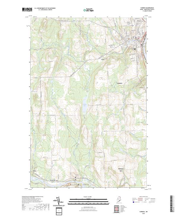
2024 Map of Caribou
USGS Topo · Published 2024About this map
Caribou serves as the regional hub for this part of Aroostook County, situated at the confluence of Caribou Stream and the Aroostook River. The landscape is a network of small settlements like Crouseville and Adaline connected by rural routes such as Washburn Rd and Van Buren Rd. Along the southern border, the Aroostook River meanders past Churchill Island and through a series of family-named cemeteries, including Munson Christy Cem and Hillside Grove Cem, which anchor the local history of the riverbank. In the town center, the Caribou Mill Pond and Caribou Court House reflect the civic and industrial core, while the presence of the CP railroad lines indicates the long-standing transport infrastructure that historically moved timber and agricultural goods through the Maine interior.
Find a feature on this map
86 named features on this map. Tap any name to fly to it.
Don’t see what you’re looking for? This feature index may not catch every label — zoom into the map to look around manually.
Map Details
Editions of this 2024 Caribou Map
This is the sole edition of this map. No revisions or reprints were ever made.
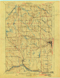
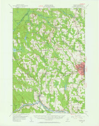
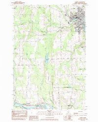
Historical Maps of Presque Isle Through Time
5 maps found