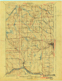
1932 Map of Caribou
USGS Topo · Published 1943About this map
The Aroostook River curves through this agricultural region of northern Maine, anchoring the commercial centers of Caribou and Washburn. This 1929 survey, updated in the early 1940s, reveals a landscape defined by an exceptionally dense network of rural schools, including the Westmanland Sch, Lundgren Sch, and Snowman Sch, reflecting the community-based social structure of the era. The Bangor and Aroostook RR connects various outposts like New Sweden Sta and PO and Ben Thomas Siding, serving as the primary artery for the region's timber and potato industries. Beyond the valley floors, prominent peaks like Capitol Hill and Gelot Hill rise above the drainage of the Little Madawaska River. A notable modern addition to the landscape is the Municipal Airport just north of Caribou, signaling the transition toward mid-century transportation infrastructure.
Find a feature on this map
101 named features on this map. Tap any name to fly to it.
Don’t see what you’re looking for? This feature index may not catch every label — zoom into the map to look around manually.
Map Details
Editions of this 1932 Caribou Map
2 editions found

Other maps of this area

1921 · Van Buren
USGS Topo · 1:250,000

1927 · Stockholm
USGS Topo · 1:48,000

1927 · Square Lake
USGS Topo · 1:48,000

1929 · Portage
USGS Topo · 1:62,500

1929 · Caribou
USGS Topo · 1:48,000

1930 · Fort Fairfield
USGS Topo · 1:48,000

1931 · Square Lake
USGS Topo · 1:62,500

1931 · Ashland
USGS Topo · 1:48,000

1931 · Van Buren
USGS Topo · 1:48,000

1931 · Portage
USGS Topo · 1:62,500