
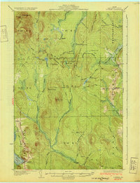
1931 Map of Portage
USGS Topo · Published 1931About this map
Portage and the surrounding unorganized townships of north-central Aroostook County reflect a landscape defined by the timber industry and wilderness transit during the late 1920s. The Bangor and Aroostook railroad cuts through the western terrain, serving the settlement of Buffalo and the logging outposts that dotted the interior. This survey captures a specific industrial transition, marking the site of the Old Shingle Mill and the Old Chain Bridge, relics of early forest extraction methods.
Find a feature on this map
66 named features on this map. Tap any name to fly to it.
Don’t see what you’re looking for? This feature index may not catch every label — zoom into the map to look around manually.
Map Details
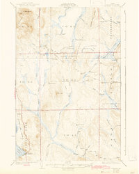
Editions of this 1931 Portage Map
3 editions found
Other maps of this area

1927 · Stockholm
USGS Topo · 1:48,000

1927 · Square Lake
USGS Topo · 1:48,000

1928 · Eagle Lake
USGS Topo · 1:48,000

1928 · Winterville
USGS Topo · 1:48,000

1929 · Portage
USGS Topo · 1:62,500

1929 · Caribou
USGS Topo · 1:48,000

1930 · Greenlaw
USGS Topo · 1:48,000

1931 · Square Lake
USGS Topo · 1:62,500

1931 · Ashland
USGS Topo · 1:48,000

1931 · Eagle Lake
USGS Topo · 1:62,500