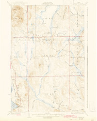
1931 Map of Portage
USGS Topo · Published 1943About this map
Portage serves as the primary settlement on this northern Maine landscape, positioned along the southeastern shore of Portage Lake. Surveyed in the late 1920s, the map reveals a wilderness economy defined by isolated camps and early industrial sites. Numerous camps, such as Holmquist Camp, Harman Camp, and Norbeck Camp, are scattered across the townships, suggesting a robust logging or sporting presence. The legacy of the timber industry is explicitly marked at the Old Shingle Mill on Goddard Brook.
Find a feature on this map
64 named features on this map. Tap any name to fly to it.
Don’t see what you’re looking for? This feature index may not catch every label — zoom into the map to look around manually.
Map Details
Editions of this 1931 Portage Map
3 editions found

Other maps of this area

1927 · Stockholm
USGS Topo · 1:48,000

1927 · Square Lake
USGS Topo · 1:48,000

1928 · Eagle Lake
USGS Topo · 1:48,000

1928 · Winterville
USGS Topo · 1:48,000

1929 · Portage
USGS Topo · 1:62,500

1929 · Caribou
USGS Topo · 1:48,000

1930 · Greenlaw
USGS Topo · 1:48,000

1931 · Square Lake
USGS Topo · 1:62,500

1931 · Ashland
USGS Topo · 1:48,000

1931 · Eagle Lake
USGS Topo · 1:62,500