
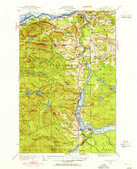
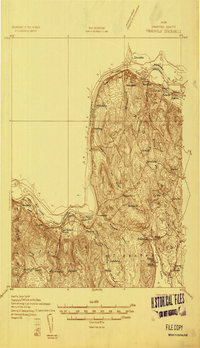
1928 Map of Eagle Lake
USGS Topo · Published 1928About this map
Violette Settlement and Michigan Settlement anchor a landscape of northern Maine forestry and rail-based commerce during the late 1920s. Along the St John River, the Temiscouata Railway and the Bangor and Aroostook define the transport corridors, connecting remote sidings like Ledges Sta and Pierre Siding to the larger world. The interior is dotted with cultural markers of small-scale agriculture and industry, from the Belanger Sugar Camp to the Ekurde Mill on the Fish River system.
Find a feature on this map
73 named features on this map. Tap any name to fly to it.
Don’t see what you’re looking for? This feature index may not catch every label — zoom into the map to look around manually.
Map Details
Editions of this 1928 Eagle Lake Map
5 editions found
Other maps of this area

1927 · Square Lake
USGS Topo · 1:48,000

1928 · Winterville
USGS Topo · 1:48,000

1929 · Portage
USGS Topo · 1:62,500

1930 · St Francis
USGS Topo · 1:48,000

1931 · Square Lake
USGS Topo · 1:62,500

1931 · Fish River Lake
USGS Topo · 1:48,000

1931 · Eagle Lake
USGS Topo · 1:62,500

1931 · Portage
USGS Topo · 1:62,500

1931 · Winterville
USGS Topo · 1:62,500
1932 · Frenchville
USGS Topo · 1:48,000