
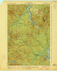
1931 Map of Winterville
USGS Topo · Published 1931About this map
St Froid Lake and the Fish River define this North Woods landscape in northern Maine during the early 1930s. The settlement of Winterville and the Quimby Winterville Sta serve as the primary hubs for this region, connected by the Bangor and Aroostook railroad and a budding network of state highways. Away from the rail line, the interior is crisscrossed by historic routes like the Wheelock Tote Road, which supported logging operations and remote camps such as Falls Camp and Fourmile Camp.
Find a feature on this map
74 named features on this map. Tap any name to fly to it.
Don’t see what you’re looking for? This feature index may not catch every label — zoom into the map to look around manually.
Map Details
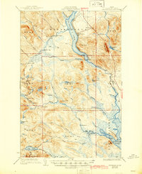
Editions of this 1931 Winterville Map
4 editions found

Other maps of this area

1927 · Square Lake
USGS Topo · 1:48,000

1928 · Eagle Lake
USGS Topo · 1:48,000

1928 · Winterville
USGS Topo · 1:48,000

1929 · Portage
USGS Topo · 1:62,500

1930 · Greenlaw
USGS Topo · 1:48,000

1930 · St Francis
USGS Topo · 1:48,000

1931 · Square Lake
USGS Topo · 1:62,500

1931 · Fish River Lake
USGS Topo · 1:48,000

1931 · Ashland
USGS Topo · 1:48,000

1931 · Mooseleuk Lake
USGS Topo · 1:48,000