1928 Map of Eagle Lake
USGS Topo · Published 1970About this map
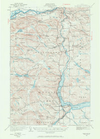
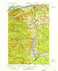
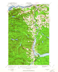
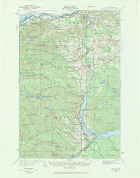
The St John River defines the international boundary between Maine and New Brunswick in this detailed survey of the North Woods. The landscape is characterized by a network of timber-and-water economy features, from Austins Dam and the Plourde Mill to numerous logging outposts like Carter Brook Camp and Fire Wardens Camp. Local agriculture and industry are further evidenced by several Sugar Camps scattered through the hills.
Find a feature on this map
122 named features on this map. Tap any name to fly to it.
Don’t see what you’re looking for? This feature index may not catch every label — zoom into the map to look around manually.
Map Details
Editions of this 1928 Eagle Lake Map
5 editions found
Other maps of this area

1927 · Square Lake
USGS Topo · 1:48,000

1928 · Eagle Lake
USGS Topo · 1:48,000

1928 · Winterville
USGS Topo · 1:48,000

1929 · Portage
USGS Topo · 1:62,500

1930 · St Francis
USGS Topo · 1:48,000

1931 · Square Lake
USGS Topo · 1:62,500

1931 · Fish River Lake
USGS Topo · 1:48,000

1931 · Eagle Lake
USGS Topo · 1:62,500

1931 · Portage
USGS Topo · 1:62,500

1931 · Winterville
USGS Topo · 1:62,500