
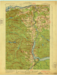
1931 Map of Eagle Lake
USGS Topo · Published 1931About this map
Fort Kent Village and the surrounding borderlands of Northern Aroostook County are defined here by a network of French-Acadian settlements and a timber-driven economy during the early 1930s. The St John River and Aroostook River serve as both natural boundaries and industrial arteries, with the Bangor and Aroostook railroad facilitating the movement of lumber and agricultural goods. Small family enclaves like Violette Settlement and Belanger Settlement are scattered across the landscape, connected by State Highway No 160 and various tote roads.
Find a feature on this map
129 named features on this map. Tap any name to fly to it.
Don’t see what you’re looking for? This feature index may not catch every label — zoom into the map to look around manually.
Map Details
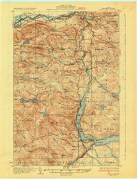
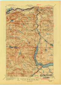
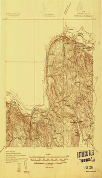
Editions of this 1931 Eagle Lake Map
4 editions found
Other maps of this area

1927 · Square Lake
USGS Topo · 1:48,000

1928 · Eagle Lake
USGS Topo · 1:48,000

1928 · Winterville
USGS Topo · 1:48,000

1929 · Portage
USGS Topo · 1:62,500

1930 · St Francis
USGS Topo · 1:48,000

1931 · Square Lake
USGS Topo · 1:62,500

1931 · Fish River Lake
USGS Topo · 1:48,000

1931 · Portage
USGS Topo · 1:62,500

1931 · Winterville
USGS Topo · 1:62,500
1932 · Frenchville
USGS Topo · 1:48,000