
1932 Map of Frenchville
USGS Topo · Published 1932About this map
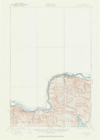
The St Johns River forms a natural international boundary between Maine and New Brunswick in this 1932 topographic study, where the Bangor And Aroostook railroad tracks mirror the river’s course. This area of northern Aroostook County is characterized by a dense network of local schools, ranging from the Roosevelt Sch to School No 17, suggesting a well-populated rural landscape tied to the river valley and timber interests. The rail infrastructure is prominent, featuring several transport hubs including Pelletier Siding, Fournier Sta, and Cleveland Siding. Inland from the river, the terrain rises toward peaks like Cyr Mtn and Morin Mtn, while water bodies such as Long Lake and Brishlotte Lake punctuate the southern reaches of the quadrangle. Settlements like Frenchville and Madawaska serve as primary anchors for a region defined by its close proximity to the Canadian border and its reliance on the railroad for connecting disparate farmsteads and logging outposts.
Find a feature on this map
48 named features on this map. Tap any name to fly to it.
Don’t see what you’re looking for? This feature index may not catch every label — zoom into the map to look around manually.
Map Details
Editions of this 1932 Frenchville Map
2 editions found
Other maps of this area

1927 · Stockholm
USGS Topo · 1:48,000

1927 · Square Lake
USGS Topo · 1:48,000

1928 · Eagle Lake
USGS Topo · 1:48,000

1931 · Square Lake
USGS Topo · 1:62,500

1931 · Eagle Lake
USGS Topo · 1:62,500

1931 · Stockholm
USGS Topo · 1:62,500

1932 · Fort Kent
USGS Topo · 1:48,000

1935 · Fort Kent
USGS Topo · 1:62,500

1935 · Frenchville
USGS Topo · 1:62,500

1938 · Grand Isle
USGS Topo · 1:62,500