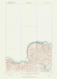
1932 Map of Frenchville
USGS Topo · Published 1973About this map
The St John River forms a prominent international boundary between the United States and Canada along the northern edge of this northern Maine landscape. Surveyed in the early 1930s, the map reveals a settlement pattern dictated by the river and the Bangor and Aroostook railroad line that follows its south bank. Small communities like Madawaska, Frenchville, and Fournier are connected by these transport corridors, which supported the local timber and agricultural economy of Aroostook County.
Find a feature on this map
37 named features on this map. Tap any name to fly to it.
Don’t see what you’re looking for? This feature index may not catch every label — zoom into the map to look around manually.
Map Details
Editions of this 1932 Frenchville Map
2 editions found
Other maps of this area

1927 · Stockholm
USGS Topo · 1:48,000

1927 · Square Lake
USGS Topo · 1:48,000

1928 · Eagle Lake
USGS Topo · 1:48,000

1931 · Square Lake
USGS Topo · 1:62,500

1931 · Eagle Lake
USGS Topo · 1:62,500

1931 · Stockholm
USGS Topo · 1:62,500

1932 · Frenchville
USGS Topo · 1:48,000

1932 · Fort Kent
USGS Topo · 1:48,000

1935 · Fort Kent
USGS Topo · 1:62,500

1935 · Frenchville
USGS Topo · 1:62,500