
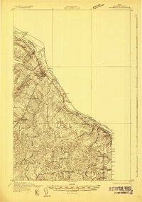
1930 Map of Fort Fairfield
USGS Topo · Published 1930About this map
The Aroostook River winds through this 1930 survey of the international borderlands, where the agricultural landscape of Fort Fairfield and Limestone is defined by a dense network of country schools and rail sidings. Small crossroads communities like Houltonville and Stevensville serve as anchors for a region tied heavily to both the Canadian Pacific Railway and the Bangor and Aroostook Railroad. The presence of numerous specialized railroad sidings, including Bishop Siding, Maines Siding, and Hardison Siding, points to the intense seasonal demand of the local potato economy.
Find a feature on this map
93 named features on this map. Tap any name to fly to it.
Don’t see what you’re looking for? This feature index may not catch every label — zoom into the map to look around manually.
Map Details
Editions of this 1930 Fort Fairfield Map
This is the sole edition of this map. No revisions or reprints were ever made.
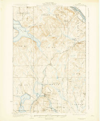
Other maps of this area

1921 · Van Buren
USGS Topo · 1:250,000

1927 · Stockholm
USGS Topo · 1:48,000

1929 · Caribou
USGS Topo · 1:48,000
1931 · Van Buren
USGS Topo · 1:48,000
1931 · Stockholm
USGS Topo · 1:62,500

1932 · Caribou
USGS Topo · 1:62,500

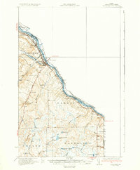
1933 · Fort Fairfield
USGS Topo · 1:62,500
1934 · Van Buren
USGS Topo · 1:62,500

1935 · Presque Isle
USGS Topo · 1:62,500

1936 · Mars Hill
USGS Topo · 1:48,000