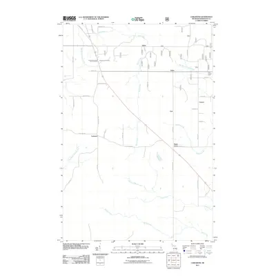
2011 Map of Carlshend
USGS Topo · Published 2011About this map
Carlshend and the surrounding rural communities of Marquette County are defined by a network of drainage systems and family-named roads in this early 21st-century landscape. The area is anchored by the Emmanuel Lutheran Church Cemetery and the crossroads at Selma, Dukes, and Lawson. High points are marked by the Skandia Lookout Tower and Dukes Lookout Tower, which overlook a terrain partitioned by a dense grid of local routes like S Carlshend Rd and N Lawson Rd. Numerous watercourses, including Sucker Creek, Huber Creek, and the East Branch Chocolay River, carve through the township. The presence of Upper Chocolay Falls and various creek branches suggests a geography of significant elevation changes and natural runoff patterns, while the concentration of smaller named settlements like Vick and Maple Grove indicates a dispersed but established rural population structure.
Find a feature on this map
44 named features on this map. Tap any name to fly to it.
Don’t see what you’re looking for? This feature index may not catch every label — zoom into the map to look around manually.
Map Details
Editions of this 2011 Carlshend Map
This is the sole edition of this map. No revisions or reprints were ever made.
Other maps of this area

1932 · Skandia SW
USGS Topo · 1:31,680

1932 · Helena NE
USGS Topo · 1:31,680

1932 · Rock NE
USGS Topo · 1:31,680

1932 · Skandia SE
USGS Topo · 1:31,680

1932 · Skandia NE
USGS Topo · 1:31,680

1932 · Harvey SE
USGS Topo · 1:31,680

1932 · Rock NW
USGS Topo · 1:31,680

1932 · Harvey NE
USGS Topo · 1:31,680

1950 · Skandia NW
USGS Topo · 1:31,680

1951 · Helena NE
USGS Topo · 1:31,680