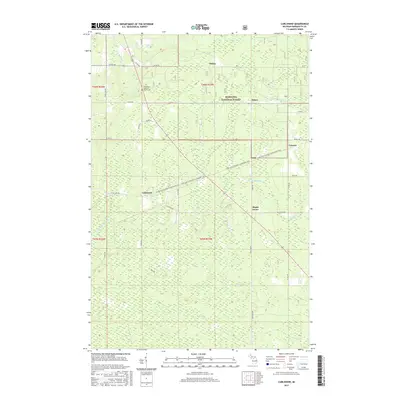
2017 Map of Carlshend
USGS Topo · Published 2017About this map
Carlshend and its surrounding hamlets occupy a landscape defined by the upper reaches of the Whitefish and Chocolay river systems within the Hiawatha National Forest. This 2017 survey shows a region where small settlements like Selma, Dukes, and Lawson are linked by a network of rural roads such as Selma Rd and Dukes Rd. A central genealogical landmark is the Emmanuel Lutheran Church Cem, located near the intersection of Co Rd Oga. The map illustrates the contemporary use of the land, highlighting the Little Lake-Chatham Snowmobile Trail cutting diagonally across the terrain, reflecting the area's transition from early pioneer farming and timbering toward a recreational and rural residential character. Waterways including McMaster Cr and Sucker Cr drain the numerous wetlands that characterize this portion of Marquette County.
Find a feature on this map
43 named features on this map. Tap any name to fly to it.
Don’t see what you’re looking for? This feature index may not catch every label — zoom into the map to look around manually.
Map Details
Editions of this 2017 Carlshend Map
This is the sole edition of this map. No revisions or reprints were ever made.
Other maps of this area

1932 · Skandia SW
USGS Topo · 1:31,680

1932 · Helena NE
USGS Topo · 1:31,680

1932 · Rock NE
USGS Topo · 1:31,680

1932 · Skandia SE
USGS Topo · 1:31,680

1932 · Skandia NE
USGS Topo · 1:31,680

1932 · Harvey SE
USGS Topo · 1:31,680

1932 · Rock NW
USGS Topo · 1:31,680

1932 · Harvey NE
USGS Topo · 1:31,680

1950 · Skandia NW
USGS Topo · 1:31,680

1951 · Helena NE
USGS Topo · 1:31,680