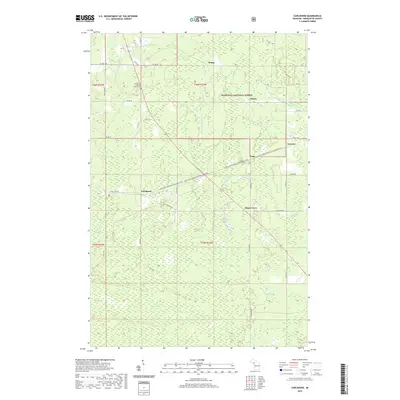
2019 Map of Carlshend
USGS Topo · Published 2019About this map
Carlshend and the surrounding timberlands of the Hiawatha National Forest define this portion of Marquette County. The landscape is a network of small settlements like Dukes, Vick, and Maple Grove, connected by a grid of rural roads and the Little Lake-Chatham Snowmobile Trail. Water drainage is dominated by the upper reaches of several systems, including the W Br Chocolay River and W Br Whitefish River, which carve through the wooded terrain. Genealogists and local historians can locate the Emmanuel Lutheran Church Cem near the northern boundary, while smaller crossroads like Selma and Lawson reflect the dispersed agricultural and logging heritage of the Upper Peninsula. The map detail highlights the specific township divisions and the numerous small creeks, such as McMaster Creek and Huber Cr, that feed the region's larger rivers.
Find a feature on this map
42 named features on this map. Tap any name to fly to it.
Don’t see what you’re looking for? This feature index may not catch every label — zoom into the map to look around manually.
Map Details
Editions of this 2019 Carlshend Map
This is the sole edition of this map. No revisions or reprints were ever made.
Other maps of this area

1932 · Skandia SW
USGS Topo · 1:31,680

1932 · Helena NE
USGS Topo · 1:31,680

1932 · Rock NE
USGS Topo · 1:31,680

1932 · Skandia SE
USGS Topo · 1:31,680

1932 · Skandia NE
USGS Topo · 1:31,680

1932 · Harvey SE
USGS Topo · 1:31,680

1932 · Rock NW
USGS Topo · 1:31,680

1932 · Harvey NE
USGS Topo · 1:31,680

1950 · Skandia NW
USGS Topo · 1:31,680

1951 · Helena NE
USGS Topo · 1:31,680