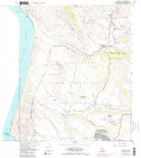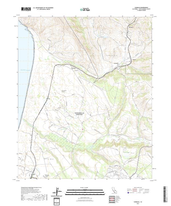
2021 Map of Casmalia
USGS Topo · Published 2021About this map
Vandenberg Air Force Base occupies a significant portion of this coastal landscape, stretching from the Pacific Ocean shoreline across the Burton Mesa and into the San Antonio Valley. The map details a transition from the operational military grounds of the base to the rolling agricultural and pastoral lands surrounding the small settlement of Casmalia. Local history is preserved in the names of several rail-related or ranching outposts such as Shuman, Antonio, Narlon, and Devon, which dot the corridor along Shuman Canyon and the Casmalia Hills.
Find a feature on this map
81 named features on this map. Tap any name to fly to it.
Don’t see what you’re looking for? This feature index may not catch every label — zoom into the map to look around manually.
Map Details
Editions of this 2021 Casmalia Map
This is the sole edition of this map. No revisions or reprints were ever made.
Historical Maps of Shuman Through Time
3 maps found