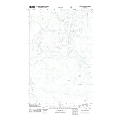
2011 Map of Cavanaugh Creek
USGS Topo · Published 2011About this map
Dyes Ranch and the high-elevation clearing of Dailey Prairie anchor this remote section of Whatcom County as it appeared in the early 21st century. The landscape is defined by the steep drainage basins of the South Fork Nooksack River, where numerous named tributaries like Skookum Creek, Arlecho Creek, and Cavanaugh Creek carve through the foothills. Industry and natural resources are evident at the Swen Larsen Quarry in the northeastern corner, while a network of forest roads, including Blue Mt Rd, provides access to the peaks of Blue Mountain and New York Mountain. The presence of small, named water bodies like Atherns Pond and the branching flow of Galbraith Creek suggest a terrain deeply shaped by water and logging history, long after the initial settlement era but before significant modern development altered these backcountry routes.
Find a feature on this map
22 named features on this map. Tap any name to fly to it.
Don’t see what you’re looking for? This feature index may not catch every label — zoom into the map to look around manually.
Map Details
Editions of this 2011 Cavanaugh Creek Map
This is the sole edition of this map. No revisions or reprints were ever made.
Other maps of this area

1909 · Mt Baker
USGS Topo · 1:192,000

1915 · Mt. Baker
USGS Topo · 1:250,000

1919 · Van Zandt
USGS Topo · 1:62,500

1921 · Wickersham
USGS Topo · 1:62,500

1951 · Wickersham
USGS Topo · 1:62,500

1951 · Van Zandt
USGS Topo · 1:62,500

1952 · Mt. Baker
USGS Topo · 1:62,500

1952 · Hamilton
USGS Topo · 1:62,500

1955 · Concrete
USGS Topo · 1:250,000

1957 · Victoria
USGS Topo · 1:250,000