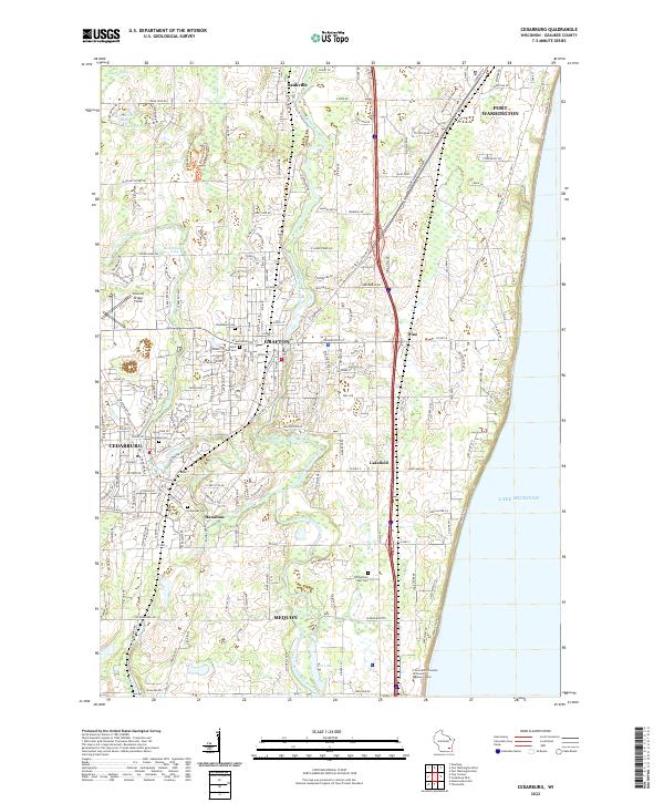
2022 Map of Cedarburg
USGS Topo · Published 2022About this map
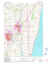
Lake Michigan forms the eastern boundary of this Ozaukee County landscape, where the Milwaukee River winds southward through the established centers of Saukville, Grafton, and Cedarburg. The terrain is defined by glacial remnants such as the expansive Cedarburg Bog and smaller water bodies like Drzewiecki Lake and Moldenhauer Lake. Modern suburban development and educational centers, including the Concordia University Wisconsin Mequon Center in Mequon, sit alongside sites of deep local heritage. Genealogists will find several notable burial grounds, such as Zur Ruhe Cem and the Old Settlers Rest Cem near Lakefield. The map also captures local recreational and landmark sites like Covered Bridge Fields and the quiet settlement of Hamilton, illustrating a region where historic town centers and natural conservation areas coexist with contemporary community growth along the Milwaukee River corridor.
Find a feature on this map
45 named features on this map. Tap any name to fly to it.
Don’t see what you’re looking for? This feature index may not catch every label — zoom into the map to look around manually.
Map Details
Editions of this 2022 Cedarburg Map
This is the sole edition of this map. No revisions or reprints were ever made.