2024 Map of Center Hill
USGS Topo · Published 2024About this map
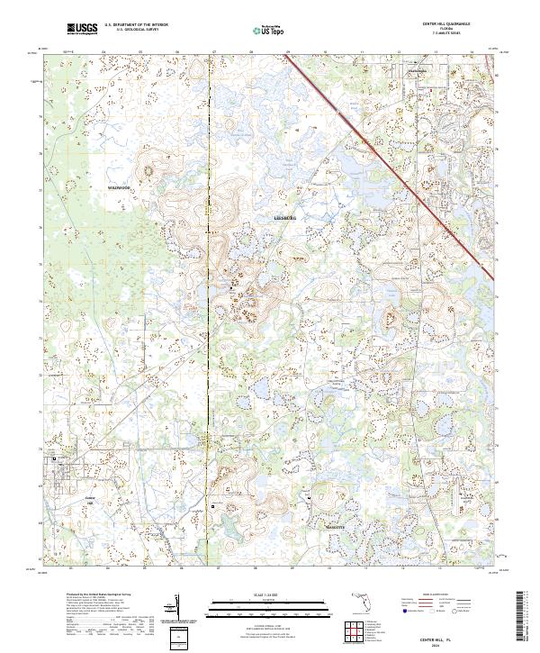
Center Hill and the neighboring settlements of Okahumpka and Mascotte anchor this landscape along the border of Sumter and Lake counties. The terrain is defined by a dense network of hydrologic features, including the Palatlakaha River and unique local names such as Baptising Pond, Bigeye Hole, and the Crowder Holes. For those tracing family histories, the map identifies several distinct burial grounds, including the Center Hill Cemetery, Cool Spring Cemetery, and the Dixon Cemetery. The presence of the Tex Merritt Private Airstrip and Grass Roots Airpark indicates a pattern of private aviation in the rural interior. In the northern sections, residential expansion is evident through the development of named residential corridors like Arlington Ridge Boulevard and Shenandoah River Trail, contrasting with the more marshy, undisturbed grounds of Wilson Marsh and Wise Hammock.
Find a feature on this map
105 named features on this map. Tap any name to fly to it.
Don’t see what you’re looking for? This feature index may not catch every label — zoom into the map to look around manually.
Map Details
Editions of this 2024 Center Hill Map
This is the sole edition of this map. No revisions or reprints were ever made.