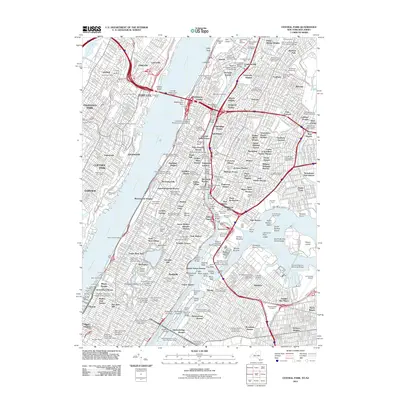
2011 Map of Central Park
USGS Topo · Published 2011About this map
The Hudson River and Harlem River define the densely populated corridor of Upper Manhattan, the Bronx, and the eastern edge of Bergen County, New Jersey. This modern topographic record details the intense urban geography of 2011, from the heights of Fort Lee near Hazard Beach to the expansive parklands of Central Park and the Great Lawn. The map provides a precise look at the neighborhood fabrics of Harlem, Morningside Heights, and University Heights, showing how major university campuses like Columbia University and Fordham University anchor their respective boroughs.
Find a feature on this map
190 named features on this map. Tap any name to fly to it.
Don’t see what you’re looking for? This feature index may not catch every label — zoom into the map to look around manually.
Map Details
Editions of this 2011 Central Park Map
This is the sole edition of this map. No revisions or reprints were ever made.
Other maps of this area

1888 · Paterson
USGS Topo · 1:62,500

1889 · Brooklyn
USGS Topo · 1:62,500

1891 · Brooklyn
USGS Topo · 1:62,500

1891 · Harlem
USGS Topo · 1:62,500

1892 · Paterson
USGS Topo · 1:62,500

1897 · Harlem
USGS Topo · 1:62,500

1897 · Brooklyn
USGS Topo · 1:62,500

1898 · Harlem
USGS Topo · 1:62,500

1898 · Staten Island
USGS Topo · 1:62,500

1898 · Brooklyn
USGS Topo · 1:62,500