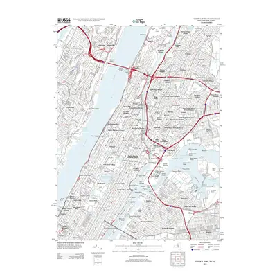
2013 Map of Central Park
USGS Topo · Published 2013About this map
Central Park serves as the geographic anchor for this urban survey, which details the dense residential and industrial corridors of Upper Manhattan, the Bronx, and western Queens. The map captures the complex connectivity of the region through a massive network of bridges spanning the Hudson River and Harlem River, including the George Washington Bridge and the Alexander Hamilton Bridge. The Bronx is characterized by established neighborhoods like Morrisania and Fordham, while the riverfronts show significant infrastructure such as the Oak Point Yard and various marine terminals.
Find a feature on this map
173 named features on this map. Tap any name to fly to it.
Don’t see what you’re looking for? This feature index may not catch every label — zoom into the map to look around manually.
Map Details
Editions of this 2013 Central Park Map
This is the sole edition of this map. No revisions or reprints were ever made.
Other maps of this area

1888 · Paterson
USGS Topo · 1:62,500

1889 · Brooklyn
USGS Topo · 1:62,500

1891 · Brooklyn
USGS Topo · 1:62,500

1891 · Harlem
USGS Topo · 1:62,500

1892 · Paterson
USGS Topo · 1:62,500

1897 · Harlem
USGS Topo · 1:62,500

1897 · Brooklyn
USGS Topo · 1:62,500

1898 · Harlem
USGS Topo · 1:62,500

1898 · Staten Island
USGS Topo · 1:62,500

1898 · Brooklyn
USGS Topo · 1:62,500