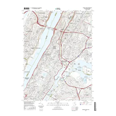
2016 Map of Central Park
USGS Topo · Published 2016About this map
Manhattan and its surrounding boroughs are shown here in a dense web of institutional and transit history during the mid-2010s. The map illustrates the concentration of cultural and educational landmarks that define the urban corridor, from the prestigious grounds of Columbia Univ and Fordham Univ to commemorative sites like General Grant National Memorial and Grants Tomb. Along the Hudson River, the massive reach of the George Washington Bridge anchors the connection between Fort Lee, New Jersey, and the heights of upper New York City.
Find a feature on this map
154 named features on this map. Tap any name to fly to it.
Don’t see what you’re looking for? This feature index may not catch every label — zoom into the map to look around manually.
Map Details
Editions of this 2016 Central Park Map
This is the sole edition of this map. No revisions or reprints were ever made.
Other maps of this area

1888 · Paterson
USGS Topo · 1:62,500

1889 · Brooklyn
USGS Topo · 1:62,500

1891 · Brooklyn
USGS Topo · 1:62,500

1891 · Harlem
USGS Topo · 1:62,500

1892 · Paterson
USGS Topo · 1:62,500

1897 · Harlem
USGS Topo · 1:62,500

1897 · Brooklyn
USGS Topo · 1:62,500

1898 · Harlem
USGS Topo · 1:62,500

1898 · Staten Island
USGS Topo · 1:62,500

1898 · Brooklyn
USGS Topo · 1:62,500