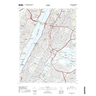
2019 Map of Central Park
USGS Topo · Published 2019About this map
Central Park dominates the center of this 2019 survey, illustrating the dense urban fabric of Manhattan, the Bronx, and parts of New Jersey. The landscape is a complex network of academic institutions, featuring the sprawling campuses of Columbia University, Fordham University, and CUNY City College. The map captures the significant elevation changes along the Hudson River, from the steep cliffs of The Palisades in New Jersey to Coogan's Bluff overlooking the Harlem River. This modern cartographic study reveals the distribution of green spaces and institutional grounds within the metropolitan area, including historical sites like the General Grant National Memorial and Hamilton Grange National Memorial. Significant transit arteries such as the George Washington Bridge and the Lincoln Tunnel connect the diverse neighborhoods of Harlem, Astoria, and Fort Lee, reflecting the region's role as a major global hub.
Find a feature on this map
152 named features on this map. Tap any name to fly to it.
Don’t see what you’re looking for? This feature index may not catch every label — zoom into the map to look around manually.
Map Details
Editions of this 2019 Central Park Map
This is the sole edition of this map. No revisions or reprints were ever made.
Other maps of this area

1888 · Paterson
USGS Topo · 1:62,500

1889 · Brooklyn
USGS Topo · 1:62,500

1891 · Brooklyn
USGS Topo · 1:62,500

1891 · Harlem
USGS Topo · 1:62,500

1892 · Paterson
USGS Topo · 1:62,500

1897 · Harlem
USGS Topo · 1:62,500

1897 · Brooklyn
USGS Topo · 1:62,500

1898 · Harlem
USGS Topo · 1:62,500

1898 · Staten Island
USGS Topo · 1:62,500

1898 · Brooklyn
USGS Topo · 1:62,500