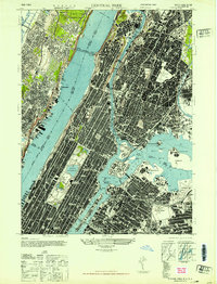
1947 Map of Central Park
USGS Topo · Published 1947About this map
Central Park and the dense urban grid of Manhattan dominate this mid-century portrait, showing the city just after the war. The landscape is defined by its massive infrastructure and cultural institutions, from the George Washington Bridge spanning the Hudson River to the academic grounds of Columbia University and Fordham University. On the Upper West Side, the Museum of Natural History and Metropolitan Museum of Art flank the Croton Reservoir, while the spiritual centers of St Patricks Cathedral and St John Divine Cathedral stand as major landmarks.
Find a feature on this map
78 named features on this map. Tap any name to fly to it.
Don’t see what you’re looking for? This feature index may not catch every label — zoom into the map to look around manually.
Map Details
Editions of this 1947 Central Park Map
This is the sole edition of this map. No revisions or reprints were ever made.
Other maps of this area

1888 · Paterson
USGS Topo · 1:62,500

1889 · Brooklyn
USGS Topo · 1:62,500

1891 · Brooklyn
USGS Topo · 1:62,500

1891 · Harlem
USGS Topo · 1:62,500

1892 · Paterson
USGS Topo · 1:62,500

1897 · Harlem
USGS Topo · 1:62,500

1897 · Brooklyn
USGS Topo · 1:62,500

1898 · Harlem
USGS Topo · 1:62,500

1898 · Staten Island
USGS Topo · 1:62,500

1898 · Brooklyn
USGS Topo · 1:62,500