2023 Map of Century
USGS Topo · Published 2023About this map
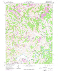
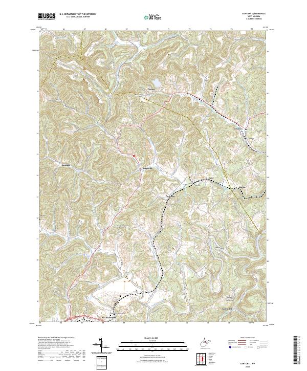
The Buckhannon River defines the southern reach of this landscape, winding through a complex topography where the borders of Harrison, Barbour, and Upshur counties converge. The terrain is a dense network of ridges and hollows drained by numerous waterways, including Pecks Run, Hackers Creek, and Left Branch Gnatty Creek. The northern settlement of Century and the southern hub of Buckhannon anchor a region characterized by small crossroads communities like Hodgesville, Ruraldale, and Volga.
Find a feature on this map
96 named features on this map. Tap any name to fly to it.
Don’t see what you’re looking for? This feature index may not catch every label — zoom into the map to look around manually.
Map Details
Editions of this 2023 Century Map
This is the sole edition of this map. No revisions or reprints were ever made.