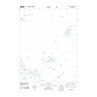
2011 Map of Chalk Mountain
USGS Topo · Published 2011About this map
Chalk Mountain and Priest Mountain dominate this high-elevation landscape in Mesa County, where a complex network of reservoirs and irrigation infrastructure defines the local geography. The map reveals an intensive effort to manage water resources for downstream use, evidenced by the numerous dams and named water bodies such as Overland Reservoir and Monument Reservoir Number 1. This early 21st-century survey documents a wilderness area heavily utilized for water storage, with many features bearing local or family-related names like Bailey Reservoir, Fisher Reservoir, and Skimmed Milk Reservoir. Significant human engineering is visible through the Overland Ditch and specialized dams such as the Holy Terror Dam and Skim Milk Dam. The terrain is characterized by high parks and ridges, including Elk Park and Willow Ridge, providing a detailed look at the headwaters of numerous creeks including West Muddy Creek and Doughty Creek.
Find a feature on this map
77 named features on this map. Tap any name to fly to it.
Don’t see what you’re looking for? This feature index may not catch every label — zoom into the map to look around manually.
Map Details
Editions of this 2011 Chalk Mountain Map
This is the sole edition of this map. No revisions or reprints were ever made.
Other maps of this area

1955 · The Meadows
USGS Topo · 1:24,000

1956 · Montrose
USGS Topo · 1:250,000

1957 · Leadville
USGS Topo · 1:250,000

1959 · Leadville
USGS Topo · 1:250,000

1959 · Montrose
USGS Topo · 1:250,000

1960 · Leadville
USGS Topo · 1:250,000

1960 · Montrose
USGS Topo · 1:250,000

1960 · Leon Peak
USGS Topo · 1:24,000

1961 · Electric Mountain
USGS Topo · 1:24,000

1961 · Porter Mountain
USGS Topo · 1:24,000