2023 Map of Chapmanville
USGS Topo · Published 2023About this map
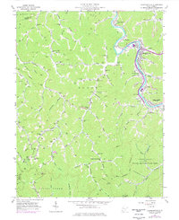
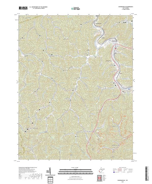
The Guyandotte River winds through the heart of this Appalachian landscape, anchoring a series of valley floor settlements from Big Creek and Stone Branch down to Chapmanville. This contemporary survey illustrates the persistent importance of the river corridor for transportation and residence, with higher elevations characterized by dozens of family-named hollows and cemeteries that reflect the region's deep ancestral roots. Small communities like Phico, Kitchen, and Sunset Court occupy narrow benches of land between the steep ridges. High-value genealogical sites are distributed throughout the terrain, including the Highland Memory Gardens and numerous smaller plots such as Workman Cem, Lily Cem, and Scaggs Cem. The map reveals the intricate network of county highways and secondary roads like Smokehouse Fork-Crawley Creek Rd that follow the winding paths of Crawley Creek and its many tributaries, connecting isolated homesteads in Seng Camp Hollow and Barker Hollow to the larger river towns.
Find a feature on this map
137 named features on this map. Tap any name to fly to it.
Don’t see what you’re looking for? This feature index may not catch every label — zoom into the map to look around manually.
Map Details
Editions of this 2023 Chapmanville Map
This is the sole edition of this map. No revisions or reprints were ever made.