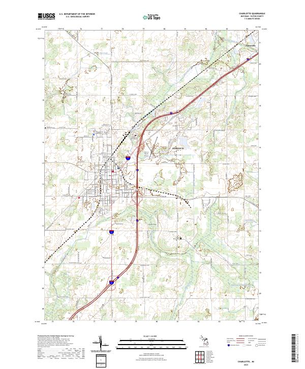
2023 Map of Charlotte
USGS Topo · Published 2023About this map
The Eaton County Courthouse serves as the focal point for Charlotte, a regional hub defined by its radial road network and proximity to the Thornapple River. This modern survey reveals a landscape where municipal growth around Fitch H. Beach Airport and Crippen Field meets the agricultural heritage of Eaton County. The surrounding countryside is marked by numerous family and community landmarks, including Maple Hill Cem, Millerburg Cem, and Center Eaton Cem, which provide essential points of reference for local historians. Waterways like Butternut Creek and Battle Creek dictate the local topography, while the Mills and Prichard Drain highlights the importance of water management in this fertile section of central Michigan. In the northeast, the settlement of Potterville sits near the confluence of major transit corridors and the winding river.
Find a feature on this map
115 named features on this map. Tap any name to fly to it.
Don’t see what you’re looking for? This feature index may not catch every label — zoom into the map to look around manually.
Map Details
Editions of this 2023 Charlotte Map
This is the sole edition of this map. No revisions or reprints were ever made.
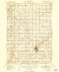
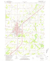
Historical Maps of Benton Township Through Time
3 maps found