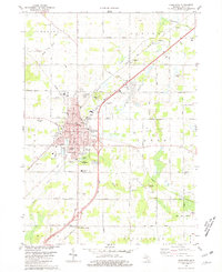
1980 Map of Charlotte
USGS Topo · Published 1981About this map
The city of Charlotte serves as the focal point of this Eaton County survey, situated at the crossing of the Grand Trunk Western railroad and the modern highway system. As a regional hub, the town is densely packed with civic and educational institutions, including the Courthouse, Library, and Armory, alongside a remarkable concentration of neighborhood schools such as Froebel Sch, Weymouth Sch, and Galewood Sch. The surrounding landscape is defined by the winding paths of the Thornapple River to the north and Battle Creek to the south, with the rural sections of Carmel, Benton, and Chester townships mapped in detail.
Find a feature on this map
62 named features on this map. Tap any name to fly to it.
Don’t see what you’re looking for? This feature index may not catch every label — zoom into the map to look around manually.
Map Details
Editions of this 1980 Charlotte Map
This is the sole edition of this map. No revisions or reprints were ever made.
Other maps of this area

1910 · Lansing
USGS Topo · 1:62,500

1912 · Lansing
USGS Topo · 1:62,500

1919 · Springport
USGS Topo · 1:62,500

1921 · Springport
USGS Topo · 1:62,500

1921 · Marshall
USGS Topo · 1:62,500

1923 · Marshall
USGS Topo · 1:62,500

1943 · Marshall
USGS Topo · 1:62,500

1949 · Charlotte
USGS Topo · 1:62,500

1958 · Grand Rapids
USGS Topo · 1:250,000

1961 · Grand Rapids
USGS Topo · 1:250,000