Loading...
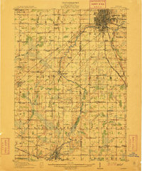
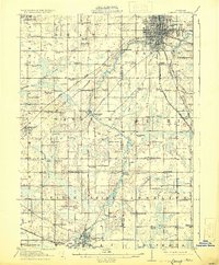
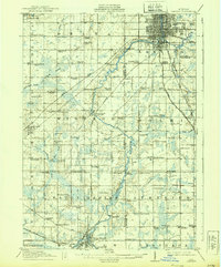
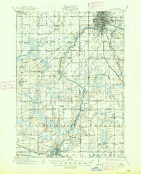
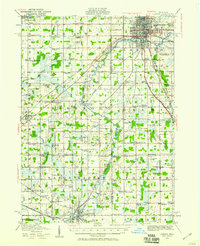
Loading map...1912 Map of Lansing
USGS Topo · Published 1912About this map
Lansing dominates the northeastern corner of this 1912 survey, where the Grand River and Cedar River converge amidst a dense grid of city streets and several radiating rail lines. The landscape quickly transitions to a rural tapestry of small townships including Delta, Windsor, and Aurelius. This era is defined by its proliferation of local institutions, evidenced by more than two dozen named schoolhouses such as Dolly Varden School, New Guinea School, and the Canada Settlement School.
Find a feature on this map
96 named features on this map. Tap any name to fly to it.
Don’t see what you’re looking for? This feature index may not catch every label — zoom into the map to look around manually.
Map Details
Date Portrayed1912
Date Published1912
PublisherU.S. Geological Survey
Map TypeTopographic
Scale1:62,500
Physical Dimensions16.4 x 19.7 inches
Editions of this 1912 Lansing Map
4 editions found
Historical Maps of Lansing Through Time

Featured Locations
Source Details
SourceU.S. Geological Survey
CopyrightPublic Domain