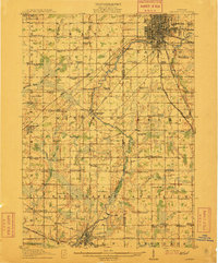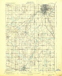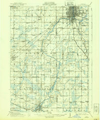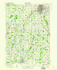
1912 Map of Lansing
USGS Topo · Published 1947About this map
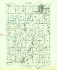
The Grand River and Cedar River converge at Lansing, anchoring a landscape defined by its transition from a growing industrial capital to the surrounding agricultural townships of the early twentieth century. This 1912 survey captures the regional rail dominance of the Pere Marquette RR and Michigan Central RR, alongside the more modern presence of the Southern Michigan Electric RR. Away from the urban core, the map reveals a dense network of nineteenth-century rural institutions, including dozens of one-room schoolhouses like the New Guinea School and Dolly Varden School, and community centers such as Canada Settlement. The prevalence of named drains like Thornapple Drain and Howard Drain indicates the extensive water management efforts required to develop the low-lying terrain between Grand Ledge and Eaton Rapids for farming and settlement.
Find a feature on this map
94 named features on this map. Tap any name to fly to it.
Don’t see what you’re looking for? This feature index may not catch every label — zoom into the map to look around manually.
Map Details
Editions of this 1912 Lansing Map
4 editions found